For Everyone
Are Your Prepared For The Next Wildfire Flood Pandemic Evacuation Record Heatwave Utilities Outage Record Snowfall
Due to the growing impact of climate change, the 2023 wildfire season was the most destructive ever recorded in British Columbia. Tens of thousands were evacuated, hundreds of homes and buildings were lost, and millions of hectares of land and forest burned.
In June of 2021 Lytton reached 49.6 degrees Celsius, the highest temperature ever recorded in Canada. The next day Lytton burned to the ground. Five months later the Fraser Valley flooded and large parts of the Coquihalla Highway crumbled. Even today, the world is still recovering from a global pandemic. It’s not if another disaster will occur -it’s when.
When disaster strikes there is not always time to pack up necessities and contact family members at home, school and work to discuss a meeting place. The time to prepare is before the disaster, and this can be as simple as having an emergency Grab n Go kit and a written home emergency plan. Here are some resources to help you prepare.
Know When Emergencies Occur
All residents should be visit and bookmark the Regional District of Kootenay Boundary Emergency Operations web portal. The portal will inform you of current emergencies and alerts.
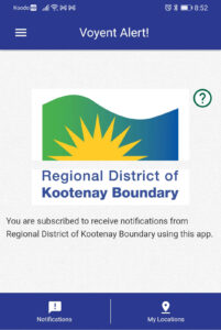
Download the RDKB Evacuation notification system for your mobile device. The RDKB uses Voyent Alert!, a multi-purpose communications and emergency notification app. The app is free, and available on Google Play and in the Apple Store.
Have a Grab n Go Kit
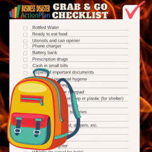
Making a “Grab n Go Kit” should be a top priority. Wildfires and floods are unpredictable and move fast. Any bag or backpack can be filled with items to help you survive the first 72 hours if you have to evacuate NOW!
Print copies of our Grab n Go Checklist, add these items to your bag or backpack, then check them off. Keep the list in your backpack as an inventory. You may not wish to keep some items such as prescription drugs or seasonal clothing in the go bag, but a quick check of the inventory will remind you exactly what else you may need to grab.
Have an Emergency Plan
Create a home emergency plan to ensure everyone in your household knows where to go and what to do in the event of an emergency. List your emergency meeting places and contact information for family members, employers, schools, healthcare providers, insurers, utilities, and other emergency contacts.
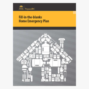
Prepared BC makes it easy with their Fill-in-the-blanks Home Emergency Plan. Make copies of your completed plan for each person’s Grab n Go kit, and keep a backup copy at work, in your vehicle, or digitally accessible.

Know Where to Go
Turn to trusted local resources for information and evacuation alerts. Conditions can change quickly, so check multiple resources to ensure you have the most current information. If travel is involved for non-localized events be sure to check road conditions at DriveBC.ca
- RDKB Emergency Operations [Website] [Facebook] [Twitter]
- City of Trail [Website] [Facebook] [Twitter]
- City of Rossland [Website] [Facebook] [Twitter]
- Village of Fruitvale [Website] [Facebook]
- Village of Montrose [Website] [Facebook]
- Village of Warfield [Website] [Facebook]
- Bounce Radio FM 95.7 MHz [Website] [Facebook]
- The Goat FM 104.1 MHz [Website] [Facebook]
- Emergency Info BC [Website] [Twitter]
Resources
In addition to local resources, there are many online resources you may want to be aware of for disaster forecasts and current conditions throughout the province. These resources can help you plan travel routes and predict how and when non-localized disasters may impact you.
EmergencyInfoBC for general emergency alerts across BC
Flood Warning & Advisory Map for information on flooding in BC
Interactive Wildfire Map for information on wildfires in BC
BC Wildfire Service for information via facebook
FireSmoke Canada Map for smoke and fire forecast information
DriveBC.ca for travel information and road conditions.
Outage Map for current and planned FortisBC outages and duration.


